


Vision
“Mulanay: Isang huwarang bayan; ligtas at payapang tahanan ng progresibo at malusog na mamamayang makadiyos, makatao at makakalikasan; may malinis at luntiang kapaligiran; sentro ng industriyang pang-agrikultura, kalakalan at arkeo-eko-turismo ng Pilipinas; na pinaglilingkuran ng mapanlahok, matapat, makatarungan, at masigasig na pamahalaan.”
“Mulanay: A model town; safe and peaceful home of progressive and healthy individuals for God, people and nature; with a clean and green environment; center of agricultural industry, trade and archaeo-ecotourism of the Philippines; served by dynamic, honest, just, and diligent government. “
Mission
“Tumupad sa tungkulin at maibahagi ang kakayahan sa mga mamamayan ng Mulanay upang paunlarin ang antas ng pamumuhay sa pamamagitan ng nagkakaisang pagkilos na may pagpapahalaga sa bawat isa.”
“Fulfill with the duty and share the ability to the citizens of Mulanay in order to improve the quality of life through cohesive action with respect to one another.”
The municipal logo is an emblem which signifies agriculture as the main source of livelihood of the people in the area. The tree inside the circle symbolizes the coconut, the tree of life. The green color signifies hope.
At the lower portion of the tree stands for the ocean which conveys clearly of the people’s secondary source of livelihood – fishing. The color red on the lower right sides symbolizes courage and valor to herald the municipality’s concern to preserve and protect the natural resources and its environment for the economic advantage of the people not only of the present but more so of the future generation.
Quick Facts
- Income Classification: 1st Class
- Congressional District: 3rd District
- No. of Barangays: 28
- Land Area per DENR(has.): 30,500
- Population (2020 PSA): 55,576
- Distance from Metro Manila (km.): 270
Points of Interest
- Mulanay Church
- St. Peter Apostle Church
- Magallanes Ancestral House
- Kamhantik Forest Park
- Mulanay’s forest of Giant Mangroves
- Balete Tree and Long Beach
- Arrowroot Cookies and Sweet Watermelon
History
The evangelization of Mulanay by the Franciscan Missionaries was in 1600 while its civil foundation as a municipality was effected in 1745 through the approval of the King of Spain. During the Spanish regime, Mulanay was composed of the municipal territories of San Narciso, San Francisco, Catanauan and San Andres which was as big as the province of Bataan. In 1755, Catanauan became a separate municipality followed by other remaining municipalities. Mulanay’s territorial jurisdiction was reduced to 42,000 hectares. The original town of Mulanay composed of six (6) barangays was raided by the Moro pirates that led the town’s executive together with the barangay heads to transfer the town site to the so called Mayordomo, a sitio of Barangay Latangan. After several years, raids along coastal areas were lessened. The people returned to the town site, however, few barangay heads disagreed and left for Bantuin, Marinduque and Mindoro.
The populace of Mulanay is composed of different ethnic groups like Tagalogs, Visayas and Bicolanos. Although they have some dissimilarity, they manage to live harmoniously with love, respect and understanding that serve as great factors valuable to social changes toward development and progress.
The first town head of Mulanay during the Spanish Regime was Alcalde Mayor Eustaquio Manlangit, while the first town mayor during the American Occupation was Mayor Atanacio Ojeda. The municipality had been under twenty-seven mayors from Spanish Regime up to present.
At present, Mulanay is composed of twenty-eight (28) barangays, four of which comprise the poblacion. The municipality is an agricultural town where farm crops like coconut, garlic, bananas, rice, corn, peanuts, mongo, ginger, squash, and other vegetables are abundantly harvested. Mulanay lies along the coast of Tayabas Bay, an abundant fishing ground.
The richness of Mulanay not only lies in its buried treasures, bountiful harvest from the vast fertile lands, but also on her industrious, peace-loving, hospitable and God-fearing people, qualities proving its impression of Mulanay sa Pusod ng Paraiso.
Etymology
The name “Mulanay” is believed to have originated from the Tagalog word “Malunay,” which means “plenty of Lunay.” “Lunay” is the vernacular term for pili wax, a natural resin found in the area. This suggests that the municipality was named after a resource that was abundant in the region during its early history.
Ecological Profile
Mulanay is a first-class suburban municipality in the province of Quezon and Situated at the 3rd District of Quezon as commonly known as the Bondoc Peninsula. The Municipality of Mulanay is one of the 39 municipal towns in the Province of Quezon. The municipality is made-up of 28 barangays classified as Upland; Coastal; Urban and Rural barangays.
Mulanay has a total land area of 42,000 hectares and can be found in the Bondoc Peninsula Area of Quezon Province. It is bounded on the north by Catanauan, on the east by San Narciso, on the south by San Francisco, Quezon and on the west by Tayabas Bay. National and provincial road networks connect Mulanay with other local government units. The area is exactly located on the coordinates of 13°31.5’ longitude and 122°24.5’ latitude. It is about 279 kilometers south-east of Manila and 142 kilometers away from its provincial capital, Lucena City.
The municipality is characterized by rugged terrain with few plains, valleys and swamps. Narrow strips of land along the coast and river valleys are available for growing crops. The undulating lowlands along the coast are well drained. The slope ranges from 0–8%, 8-18% and above. The highest slope is at Barangay Burgos which has a slope of 30% and above. The elevated portion is at 384 meters above sea level at Mount Maglayao (Mt. Camhantik), Barangay Buenavista. Its susceptibility to erosion is directly proportional to the slope percentage and to the degree of susceptibility.
As per report of the Bureau of Soils in Quezon Province, Mulanay has two soil types: the Faraon Clay Loam and the Catanauan Clay Loam. Around 87.07% of the soil that cover Mulanay is Faraon Clay Loam. This soil type is the most extensive upland soil of the Province, mostly found in the Bondoc Peninsula Area.
Stratified rock formation in Mulanay was form about 66 Million Years ago. Newly formations are Quaternary Alluvium which consist of unconsolidated river and beach deposits. Another is Malumbang Formation which is essentially cream buff or sandy dirty white sandy and fossiliferous limestone with local interbeds of fossiliferous siltstone and medium to coarse grained stone that are commonly found on the coastal barangays and interestingly seen on the part of the Buenavista Protected Landscape of Mulanay. Another one is Canguinsa Formation which is are predominantly sandstone with interbeds of Calcareous Shale Conglomerate and sandstone form which is common on the southeastern part of the Municipality. And the last formation is the Vigo Formation comprised predominantly by shale with interbeds of sandstone and limestone which is the oldest and locally carbonaceous which is dominant on the Northern part of the Municipality.
Climate in the municipality is classified as wet months or rainy season and dry months or dry season. Rainy season is from June to February while dry season is from March to May. Mulanay is greatly affected by the annual south monsoon wind from July to September. Affected primarily are the coastal barangays and the fishing industry. The prevailing wind system is easterly becoming north-easterly in the afternoon. Mulanay’s climate is considered similar with San Francisco’s climate, both are under Type III in the Modified Corona System.
Based on the data from the Department of Environment and Natural Resource (DENR), Mulanay has a total of 19,220 hectares of Alienable and Disposable Land (A&D), 10,703 hectares within Forest Land/Timberland and 2,103 which are Unclassified Land. Based on the assessment and survey conducted by the Municipal GIS Team, the actual Dense Covered Forest range to 400 to 500 hectares only, the Forest land gradually converted to Agricultural land from the year 1920 to 2000.
Mineral Resources that are found and operated in the locality are all non-metallic such as Sand, Gravel, Earth, Stones, Cobbles, Boulders, Coral Rocks, and Crushed Rocks which are found in Barangays Sta. Rosa, Sto. Nino (Ajos), Butanyog, Canuyep, Patabog, Ibabang Yuni, Ilayang Yuni and Sagongon. Another is selected borrow (aggregates) which are dominantly found in Barangays Buenavista, San Isidro, Canuyep, Cambuga, and Ibabang Yuni.
The main source of potable water in Mulanay comes from springs located in Barangay Buenavista. Other water sources/springs are located in other rural barangays, namely: Bagong Silang, Bagupaye, Cambuga, F. Nañadiego, Latangan, Matataja, Pakiing, Patabog, Sagongon, San Isidro, San Pedro, Sta. Rosa, and Ajos (Sto. Niño). Some barangays, on the other hand, depend on open dug wells, shallow wells, and deep wells for water.
Inland water resources of the Municipality come from the four major river systems namely Ajos River Watershed, Mulanay River Watershed, Patabog River Watershed and Yuni River Watershed.
Relative to the Comprehensive Land Use Plan, the functional role of the Municipality of Mulanay in Quezon was identified as a major supplier of food in the province of Quezon particularly in coconut, rice, corn, watermelon, vegetables, fishery, livestock and arrow root (uraro) cookies production that will contribute to the total development of the province. Under RA 7916, otherwise known as the Philippine Economic Zone Act of 1995, Mulanay is one of the designated areas for industrial purposes. In pursuance of this functional role, a total of 68.46 hectares have been earmarked for industrial (4.95 hectares) and agri-industrial (63.51 hectares) endeavors. In terms of the hierarchy of centers, large towns are proposed based on the development potentials, environmental impact and population growth. Among these are Mauban, Calauag, Pagbilao, Mulanay, San Francisco, Atimonan and Lucban. Services provided by these settlements include banking, education, health, recreation facilities, marketing and shopping centers, large agri-industrial plants, warehouses, processing, and power source.
Demography
Based on the 2022 CBMS Survey, Mulanay has a population of 54,068. And if the growth rate stays at 1.20%, that number is expected to climb to 59,482 by 2030. That’s an increase of over 5,400 residents in just eight years.
The survey also revealed that there were 13,333 households in Mulanay in 2022. Typically, the average number of people per household in the barangays ranges from 4 to 5, and the overall average for the municipality is 5. With the projected population growth, we can expect the number of households to rise as well. This population growth could bring both opportunities and challenges for Mulanay. It’s important to plan for the future to ensure the town can accommodate the growing number of residents while maintaining its quality of life.
Health and Nutrition
General Health Situation
Health and sanitation come as one of the top priorities of the current administration by expanding health services in the municipality. Much have to be addressed considering the limited financial resources in line with the demands in the health sector.
Health Facilities and Personnel
The municipality has twenty-three (23) health facilities consisting of one (1) Rural Health Unit (RHU), 21 Barangay Health Stations (BHS), and two (2) private health facilities. Health service in the municipality is expanded through the lying-in under the RHU. This expansion and the Pantawid Pamilyang Pilipino Program of DSWD encourage pregnant mothers to periodically have their maternal check-up and delivery in the lying in to avoid cases of maternal and infant death.
Leading Causes of Mortality
In 2020 and 2021, Acute Myocardial Infarction ranked first among the leading causes of mortality having a percentage of 21.68 and 36.04 respectively. In 2021, 24.88% or 49 persons died due to Cerebrovascular Disease and Hypertension. However, pneumonia caused the mortality of 20 persons (15.38%) during 2020. There are more males who died than females.
Primary Causes of Morbidity
Acute Respiratory Infection remained as the leading cause of morbidity in the municipality throughout the past four years followed by skin disease. Other diseases include headache (cephalgia), hypertension, acute bronchitis, wounds, iron deficiency anemia, vertigo, urinary tract infection, and acute gastro enteritis. The year 2019 and 2020 recorded the most number of death in the Municipality and it is proportional to the cases of COVID-19.
Crude Birth Rate
There is a fluctuating crude birth rate in the municipality over the past four years. Fluctuation could be explained on the widening gap between the number of registered births and total population. In 2018, registered births totaled to 620 that blew down to 501 in 2021 and went up significantly to 818 on 2022.
Crude Death Rate
Consistent to the crude birth rate, death rate in Mulanay showed fluctuation. In 2018, the crude death rate was 3.54% while in 2019 is 3.45% and, in 2020 is 3.34, 2021 to 2.80 and 2022 goes up again to 3.52. Year 2021 was the lowest recorded deaths during the past five years. The fluctuation can be explained by the total registered deaths from 2018 to 2022.
Maternal and Child Death
(1) Number of Registered Births by Age of the Mother per Year
As of 2014, registered births totaled to 1,081 wherein most of the mothers were in ages 20-24. There were also child deliveries recorded among mothers who are 15 years old and below (36) and 40 years old and over (37). Considering the high number of registered births in Mulanay, however, there were recorded cases of maternal deaths caused by post-partum hemorrhage.
(2) Births by Place of Births and by Attendance per Year
Due to the distance of most of the barangays to the poblacion areas and the absence of a hospital in the municipality, majority of child deliveries in Mulanay took place at home. Majority of these child deliveries were attended by a trained “hilot”, while other were attended by medical personnel and untrained “hilot”.
(3) Infant Mortality per 100,000 Live Births by Leading Causes
Among the leading causes of infant mortality, prematurity served as the highest number among the causes of infant death. Some causes include, hemorrhagic ischemic encelophaty, pneumonia, asphyxia, sepsis, bacterial sepsis, measles, acute infant respiratory distress syndrome, neonatal aspiration, sudden infant death syndrome, skin infection, respiratory distress, severe dehydration, intra uterine hypoxia, bronco pneumonia, and SIDS. Year 2011 recorded the lowest number (4) of infant death while year 2010 had the highest number (12) of infant mortality.
(4) Maternal Care
About 16% of women have been provided with maternal care through four or more prenatal visits. About five percent have been given two doses of TT while almost 15% were given TT2 plus. A plurality of the pregnant women was given iron and other vitamins. Nine percent of these pregnant women initiated breastfeeding at this period.
(5) Nutritional Status of Children
Comparatively, nutritional status of children ages 0-5 improved yearly. Malnutrition showed a yearly decline Out of the 1, 396 (20%) the total number of malnourished children ages 0-5 in 2010 incurred a decline of 1% during 2011, 1.19% in 2012, 2.63% in 2013 but there is a noted increase of 1.46% in 2014. Underweight and overweight continuous to decline from 2010 to 2012 but with a noted increase in 2013 and 2014, while severely underweight continued to increase during 2010 to 2012 but registered decline in 2013 and 2014.
According to the 2014 data of the RHU, out of the 1,909 children weighted during the year, 1,567 or 82.08% had a normal weight whereas the number of females is higher than males; 202 or 10.58% were underweight; 27 0r 1.41% were severely underweight; and 113 or 5.92% were overweight.
Disability
About 0.09% of children with ages 0-5 are reported to have oral defect and 0.05% with Mental Retardation. 0.01% or 1 had one leg and totally blind, 0.02% or 2 are having disability of one hand and partially blind and 0.22% having a disability that is undefined.
Eight hundred forty (840) or 1.59% of populace aged 0-103 have disabilities. There were more males having disability than females. Brgy. Ilayang Yuni registered the highest number of population with disability having a percentage of 9.40 while Brgy. Anonang had the lowest number where only 1 person with disability.
Sanitation
Of the 11,384 households, 6,810 have their own toilet with flush, while 4, 038 don’t have any toilet facility, and 167 have open pit as their toilet facility. Among the listed barangays below, Brgy. Pakiing (374) the most number of households who don’t have toilet facility followed by Brgy. Ibabang Yuni (283). However, Brgy. 3, Poblacion had the least number where zero household don’t have toilet facility.
Solid waste Generation
Total waste generation in the municipality is 10,728.75 kgs. /day and only 2, 304.91 kgs. /day were collected. Waste is disposed in an open dumpsite in Barangay Cambuga. Most of the waste is generated by domestic which produce 9, 030. 70 kgs. /day.
Cemeteries and Memorial Parks
As of 2014, Mulanay has four cemeteries/ memorial parks where three of them are considered private and one is public. Private cemeteries are in Poblacion while public is located at Brgy. Butanyog. Families or relatives of the dead must get death certificate from the civil registrar office. The public cemetery is already congested, thus re-uses of older graves of relatives or forgotten graves are being practiced. During the past decades, the cemetery served as a graveyard where the dead body is being buried in the ground only marked by a wood marker, but as the days passed it led to the construction of tomb for aboveground internment provided with headstone. There must be a chapel in the cemetery where funeral ceremonies may be held and may serve as haven for funeral participants against sun and rain. The Local Government Unit is now pursuing to find out a suitable site for another cemetery and/or extension of it.
Education
Education is a right of every individual. This should always be one of the top priorities of each administration, thus, explains why the current administration focuses more on education. Current local programs include the establishment of NOPTI and the Alternative Learning System (ALS) for out-of-school youths.
School Facilities
Mulanay has 25 public schools located in each barangay and two (2) private schools located in the Poblacion areas. The facilities of the public schools include laboratory, library, clinic, comfort room, and playground. While the other facilities are in good condition, some of these specifically the comfort rooms are in poor condition which need minor repair. On the other hand, most of the facilities of private schools are in good condition. Further, most of the schools remained untitled and area occupied by the school does not obtain the standard size of area and students ratio of 1:35.
Elementary Public and Private Schools
To date, there are already 27 elementary schools in the municipality wherein 25 are considered public which are located mostly in rural barangays and one (1) in Poblacion. Two other schools are considered private which are located in Barangay Butanyog and Poblacion III. Of the listed barangays below with established elementary schools, three barangays in the municipality do not have elementary school namely, Amuguis, Bagong Silang, and Sagongon.
Secondary Public and Private Schools
As of 2010, Mulanay has seven (7) public secondary schools and two (2) private. Public schools are mainly located in rural barangays whereas the two private schools are in Poblacion III.
Classrooms and Teachers Needs
Most of the elementary schools in the municipality did not obtain the standard student-teacher and student-classroom ratio of 1:35 as per DepEd. Employment of additional teachers and building of classrooms must be considered in planning. While public secondary schools only need additional classrooms.
Student–Teacher and Student–Classroom Ratio
Among the public elementary schools, Mulanay has a student-teacher ratio of 1:40 which means that there is one (1) teacher for every 40 students. Further, student-classroom ratio in the public schools is 1:38 which means that in every classroom, 38 students are occupying it. This shows a congested student-classroom and student-teacher ratio where there should be only 35 students in a classroom handled by teacher as per DepEd. Public secondary schools have a student-teacher ratio and student-classroom ratio of 1:28 and 1:36 respectively. On the other hand, private elementary schools have a student- teacher ratio of 1:15 and a student-classroom ratio of 1:21. Private secondary schools have a student-teacher ratio of 1:22 and a student-classroom ratio of 1:39.
Area Requirement
As of 2014, majority of the public elementary and secondary schools needs an expansion. The area they occupied is not suitable in the number of classes they have. Schools like, Burgos Elementary School, Matataja Elementary School, Pakiing Elementary School, and Parang Elementary School which has lower number of classes are not in need of expansion.
(6) Tertiary and Vocational/Technical Schools
Polytechnic University of the Philippines (PUP) has been the only tertiary school in Mulanay. Female enrollees account to 68% (603) of the total population and male enrollees cater only the remaining 32% (292). Aceba Systems Technology Institute remains the sole vocational school provider in the municipality. It is a private facility consisting of 23 male enrollees and 43 female enrollees. It means that more females attend tertiary and vocational schools than males.
Historical Enrollment
Enrollment in public elementary level has been decreasing in the four consecutive years but with a small increment in the last school year. However, public secondary level has been gradually increasing over the last five years. Private elementary level has a decreasing enrollment but with a noted increased in the year three while there is recorded decrease of enrollment in private secondary level during the year five. Vocational school has its rise and fall pattern.
Projected Classroom, Teacher Requirement
A small increment is noted in terms of projected classroom and teacher requirements for the elementary and secondary levels within the planning period. Such number of teachers and classrooms will have to be factored in the planning for school buildings and employment of teachers.
Historical Enrollment Participation Rate
There is also a continuous decrease of enrollment participation rate on Elementary level and increase on the Secondary level. There is a 13.63% recorded decreased from the year 2011 and year 2014 in terms of elementary level contrary to the 6.66% increase in Secondary level.
Educational Attainment and Attendance
A large percentage of the people in the municipality were not able to finish elementary. Based on the data gathered from RCBMS 2014, only 13% (5,794) of the total population of Mulanay graduated from elementary. About 17% (7,685) of the population finished secondary, and only 58 (0.12%) of the population was academic degree holder.
Majority or 87.69% of the 5-17 years old or elementary and secondary school population of each barangay attends school. Brgy. 3, Poblacion ranked first, where 96.92% or 377 out of 389 population attends school while Brgy. Bagong Silang ranked last having a percentage of 70.51 where 55 out of 78 population attends school. There were also more females attending school.
One out of 8 (12.31%) persons in the municipality is a school dropout. Barangay Bagong Silang has the highest number of school dropouts with (29.49%), followed by Ajos (27.87%) and Ibabang Yuni (24.70%). There were more male dropouts than females in most barangays except in Barangays Anonang, Poblacion I, Buenavista, Ilayang Yuni, Patabog and Sta. Rosa. Barangay Poblacion 3 was recorded with the lowest number of dropouts (3.08%).
Social Welfare Services
Records showed that all barangays in the municipality have day care centers in good condition. Each Day Care Center implements the Early Childhood Development Project which offers day care services and supplemental feeding to day care children. Each Day Care Center has a designated barangay day care worker in which 36 of them are already accredited through the ECCD Center Based Accreditation System. There is also an existing Senior Citizens’ building located at Brgy. Poblacion 4.
Aid to Individual in Crisis Situation (AICS) provides assistance in the community in terms of medical, burial, transportation, educational, livelihood, and financial. Medical Assistance is the highest assistance disbursed by MSWD throughout the past three years while least number of clients availed the livelihood assistance disbursed only during 2014.
A great majority (82.32%) of the population do not have health insurance. About 44% have Philhealth coverage while the rest have private health insurance and blue card/yellow card coverage. Both males and females have equal access to Philhealth. More than half of the population availed the Pantawid Pamilyang Pilipino Program having 12,100 males and 11, 304 females.
Housing
The concern for the security of families and children covers matters on housing and housekeeping. These have been traditionally committed as primarily women’s burdens. Thus, LGU services for temporary settlements with makeshift housing require attention to lessen women’s burden.
As of 2014, there is a total of 2,911 housing backlog. Highest are households within the danger zone areas that is for relocation. It totaled to 2,280 where it caters the 78.31% of the total housing backlog. While housing unit considered as makeshift/salvaged/improvised caters the 390 or 13. 40%.
There is no existing condominium in the municipality but there are two existing subdivisions. They are both economic housing by type and located at Brgy. 3, Poblacion.
At present, there are existing resettlement areas in the municipality. Eight hundred forty-three (843) housing units were distributed to 842 households in Mulanay. Among the 843 housing units, 73 were administered through the Core Shelter Project of the Department of Social Welfare and Development and are located at Brgy. Canuyep, 78 units were administered by Gawad Kalinga Foundation in Brgy. Butanyog, 500 units scattered in various barangays were administered through Red Cross and 192 units were administered through Department of Public Works and Highway in Brgy. Ajos. All resettlement areas were provided with complete utilities/facilities/amenities.
Protective Services
Public Order and Safety
Protective services facilities and equipment in 2014 include a police headquarter in the Poblacion area with a 1:2,574 personnel to population ratio and Fire Station with a fireman to population ratio of 1: 7,722. Facilities registered as in poor condition. Vehicles include two (20 firetrucks for the firemen and one (1) Toyota hi-lux and 1 Mahindra for the policemen.
Volunteer protective services in the municipality include traffic, peace and order, disaster management, auxiliary services, and others. More than half (624) of the 1,030 volunteers are in the disaster management while volunteers in peace and order catered to (302) almost one forth. Equipment include flashlight, generator, radio, rescue rope, rain coat, power saw and megaphone. All barangays have their own outpost in the area.
Crimes
Reported index crimes committed by men in Mulanay have been decreasing since 2010. The same trend was seen in non-index crimes which are serious in nature and occur with sufficient frequency and regularity. Generally, except for rape, these crimes are readily reported to police authority.
Among the identified crimes that happened in the municipality, physical injuries registered the highest incidence with 32.43% of the total number of households inflicted. A total of 94.59% or 35 households were inflicted by index crimes while 5. 41% or 2 households were inflicted by non-index crimes.
Meanwhile, fire incidence rarely occur in the municipality.
Based on the current and projected population, requirement for police and fire personnel is steadily increasing. The number of force was projected based on the 1:1,000 police to population ratio and 1:2,000 firemen to population ratio. The current and projected requirement for policemen and firemen is more than half of its existing population.
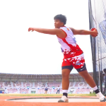
Sports and Recreation
The Poblacion has covered and open basketball courts. Each barangay in the municipality has a basketball court. While all of these are in good condition, only Barangay Poblacion I and Sta. Rosa have covered courts. There are no other recreational facilities in the barangays except for the facilities in the Poblacion and School open area.
Economy
Revenue Source
Industries in the municipality vary mostly between agricultural and non-agricultural. In the agricultural industries, 51.05% is engaged in agriculture, forestry and fishing. In the nonagricultural industries, there are more unskilled laborers than skilled. There are more male earners (62.95%) recorded in the agricultural operators group than female earners (17.02%). There are more female earners in the own household activities, education, human health and social work activities and professional/technical group.
Employment
Barangay San Pedro topped the list in terms of percentage of males and females employed or earning in the municipality with 41.12%. It is followed by Barangays Matataja (38.88%) and Amuguis (38.04%). Barangay San Pedro has the highest percentage of males employed or earning with 28.47% while Barangay Amuguis with 13.64% registering the highest percentage of females employed or earning.
Unemployment
Out of the 28 barangays in the municipality, Barangay 2 (Pob.) has the highest income percentage at 12.25% followed by Ibabang Cambuga (8.53%), Santa Rosa (6.83%), Pakiing (7.03%) Ilayang Yuni (6.02%) and Bagupaye (5.56%). Barangays which have the lowest income percentage are Bagong Silang (0.37%), Sagongon (0.41%), Bolo (1.32%), Buenavista (1.49%), and Barangay 4 (Pob.) (1.81%). Based on these data, we can conclude that in terms of income distribution and purchasing power, the people in Barangay 2 (Pob.) are the wealthiest in the municipality while the people in Bagong Silang are the most deprived.
These conditions exists due to household and family duties or housekeeping, schooling, too young/retiree/permanently disabled while others are awaiting results of previous job application, bad weather, temporary illness/disability, tired/believes no work is available, waiting for rehire/job recall and others.
Physical Infrastructure
Transport and Utilities
a) Municipal Road
At present, the Municipality of Mulanay has 8.78 km municipal road in which 6.72 is concrete and 2.05 is graveled. Latangan Road, P. Burgos St. and Peninsula Subdivision to Latangan Road is Susceptible to Flooding. Reference is given below for the kilometer breakdown of each concreted street in the Poblacion.
b) Farm-to-Market Roads
The municipality has 162.99 kilometers FMR within the 22 rural barangays that were constructed in partnership with the Bondoc Development Program (GTZ); ARISP II; ARCDP I & II (WB); and KALAHI-CIDSS KKB Project (WB).
Of the 162.99 kilometers FMR, 12.71 kms are concrete while 116.10 kms are graveled and 34.18 is earth. Reference is given below for the type, kilometer length and funding agency of each farm-to-market road projects.
c) National Roads
There are a total of 42.701 kilometers national road from Mulanay to Catanauan, Mulanay to San Narciso, and Mulanay to San Francisco. Of 42.701 kilometers, 42.201 kilometers is concrete and about 0.8 kilometer is graveled.
d) Bridges
The municipality has 32 bridges with a total length of 936.91 meters. Of 32 bridges, 23 are concrete, steel or bailey and the rest are made of timber. By type of administration, national bridge totaled 324.11 meters in length while the municipal/barangay bridge totaled to 612.80 meters. There are daily routes of buses, jeepneys, and vans to other municipalities and any time to common areas in the municipality using motorcycles like “tricycles or top-down” and “habal-habal”.
e) Other modes of Transportation
Barangay Poblacion IV and Patabog provides another mode of transport, which has a wharf that services passengers from in and out of the coast in the municipality. There are also pump boats plying from nearby province of Marinduque and nearby towns.
In the past three years, three accidents in 2012 has been reported as Road Accidents in the municipality. Five accidents happened on 2013 and seven on 2014.
Communication Facilities
Communication service facilities in the municipality turns in various ways. There is an existing radio station located at Brgy. Poblacion 4 that provided daily news and updates not only in the residents of the locality but also to other cities and provinces in the Philippines. LGU-IDS during disaster likewise benefited the populace of Mulanay. This aims to prevent casualties during disaster by sending text messages informing the status of the disaster that helps attain the zero casualties objectives of the municipality.
Publicly managed postal service and telephone service are available in the locality. Private communication service providers include internet providers and cell sites networks. Communication network is nevertheless present in the area with 5 communication towers located in Barangays Butanyog, Buenavista, Ilayang Yuni and Poblacion. Only Northern part of Mulanay has a limited signal coming from each network site.
General Telephone System Inc. is the sole Telephone System Operating in the municipality located in Barangay 2 (Pob.). There is only one cable station in Mulanay which that is the Peninsula Cable TV System located in Barangay Ajos (Sto. Niño).
Power
Electricity in the municipality is being controlled by the Quezon Electric Cooperative, Inc. (QUEZELCO). Quezelco started its operation on April 24, 1972. As of 2014 there are 5,965 actual electric connections provided in the 28 barangays of Mulanay.
Almost half of the population in Mulanay still does not have direct access to electricity. Brgy. Bolo has the highest number of households without electric connection (180 or 82.57%) while Brgy. 3 (Poblacion) has the least number of households without electricity (2 or .72%).
Water
Almost 83% of the households in the municipality are using non-potable or doubtful drinking water. Assessment results finds the presence of Coliforms and Bacterias. Together with the DOST with their Program Community Empowerment thru Science and Technology reveals that all barangay where there is an overwhelming majority of households using untreated Level I, II, and III water systems like Dug wells, unprotected springs and community water systems.
Mulanay Water Sanitation and Services Unit run by the LGU is the sole Level 3 Water Service provider in the Municipality. A total of 72 surveyed water service provider are endorsed to the National Water Resource Board database. 47 water service providers have Level 1 water system and 24 Level 2 water service facilities are distributed in each Barangays also have concrete reservoirs.
Although Mulanay is rich in water resources, there is also a need of potable water sources in the municipality. Computed based on water consumption per person (0.123288 m3/per day), as of 2022 the locality has a total of 2,129.90 cubic meter per day (CMD) compared to the requirement of 6,500 CMD there is a total deficit of 4,370 CMD. As projected, the 62,444 population in the year 2025 has a water requirement of 7,699 m3 per day. Henceforth, there is a need to develop and maximize water consumption to accommodate future water needs.
LGU DATA PORTAL
| INDICATORS | 2022 DATA | |||
| ECONOMIC DYNAMISM | ||||
| 1. Size of the Local Economy | 1.1. Gross Sales of Registered Firms | 297,114,776.80 | ||
| 1.2. Total Capitalization of NEW Businesses | 10,133,000.00 | |||
| 2. Growth of the Local Economy | 2.1. Gross Sales of Registered Firms | 0.22 | ||
| 2.2. Total Capitalization of NEW Businesses | -0.3 | |||
| 3. Active Establishments in the locality | 3.1. Total Number of Business Registrations | 3.1.1.Number of approved business permits for NEW business applications | 75 | |
| 3.1.2. Number of approved business RENEWALS | 513 | |||
| 4. Safety Compliant Business* | 4.1. Number of Occupancy Permits Approved | 502 | ||
| 4.2. Number of approved fire safety inspection | 566 | |||
| 5. Employment Generation | 5.1. Number of declared employees for NEW business applications | 240 | ||
| 5.2. Number of declared employees for business RENEWALS | 825 | |||
| 6. Cost of Living | 6.1. Local Inflation Rate | 7.4 | ||
| 7. Cost of Doing Business | 7.1. Cost of Electricity of Commercial Users | 13.83 | ||
| 7.2. Cost of Water of Commercial Users | 50 | |||
| 7.3. Price of Diesel as of December 31 per year | 68 | |||
| 7.4. Daily Minimum Wage Rate | 7.4.1. Agricultural | 7.4.1.1. Plantation | 390 | |
| 7.4.1.2. Non-Plantation | 390 | |||
| 7.4.2. Non-Agricultural | 7.4.2.1. Establishments with more than 10 workers | 429 | ||
| 7.4.2.2. Establishments with 10 workers or below | 350 | |||
| 7.5. Cost of Land in a Central Business District | 2397.11 | |||
| 7.6. Cost of Rent of the Largest Commercial Space in the Locality | 200 | |||
| 8. Financial Deepening | 8.1. Number of Universal/Commercial Banks | 2 | ||
| 8.2. Number of Thrift and Savings Banks | 1 | |||
| 8.3. Number of Rural Banks | 5 | |||
| 8.4. Number of Non-Bank Financial Institutions (microfinance, cooperatives) | 9 | |||
| 8.5. Number of Pawnshops/Money Changers / Foreign Exchange/Remittance Center | 64 | |||
| 9. Productivity | 9.1. Gross Sales of Registered Firms | 297,114,776.80 | ||
| 9.2 Number of declared employees for business RENEWALS | 825 | |||
| 10. Presence of Business, Professional and Civil Society Organizations | 10.1 Total number of LGU recognized / registered business groups | 198 | ||
| GOVERNMENT EFFICIENCY | ||||
| 11. Compliance to National Directives | 11.1. Comprehensive Development Plan (CDP) | 11.1.1. Presence of CDP | YES | |
| 11.1.2. Year of Last Update | 2020 | |||
| 12. Presence of Investment Promotion Unit | 12.1. Order/Resolution Creating Code | YES | ||
| 12.2. Date of Last Update | 2018 | |||
| 12.3. Presence of Office and Staff | YES | |||
| 13. Compliance to ARTA Citizens Charter | 13.1. Submission of Citizens Charter to ARTA | YES | ||
| 13.2. Visible Citizens Charter in the LGU Office | YES | |||
| 14. Capacity to Generate Local Resource | 14.1. Business Tax collected by the LGU (in Php) | 3,835,016.46 | ||
| 14.2. Real Property Tax collected by the LGU (in Php) | 3,866,290.57 | |||
| 14.3. Total Revenues of the LGU (in Php) | 324,667,899.65 | |||
| 15. Capacity of Health Services | 15.1. Capacity of PUBLIC Health Services | 15.1.1 Doctors | 2 | |
| 15.1.2. Nurses | 14 | |||
| 15.1.3. Midwives | 13 | |||
| 15.1.4 Medical Technologists | 1 | |||
| 15.2. Capacity of PRIVATE Health Services | 15.2.1. Doctors | 3 | ||
| 15.2.2. Nurses | 3 | |||
| 15.2.3. Midwives | 0 | |||
| 15.2.4 Medical Technologists | 1 | |||
| 15.3. Ratio of Doctors in Public and Private Health Services to Population | 0.0001 | |||
| 15.4. Ratio of Nurses in Public and Private Health Services to Population | 0.0003 | |||
| 15.5. Ratio of Midwives in Public and Private Health Services to Population | 0.0002 | |||
| 15.6. Ratio of Medical Technologists in Public and Private Health Services to Population | 0.0000 | |||
| 16. Capacity of School Services | 16.1. Secondary Education Schools | 16.1.1. Number of PUBLIC School Teachers | 247 | |
| 16.1.2. Number of PUBLIC School Students | 6226 | |||
| 16.1.3. Number of PRIVATE School Teachers | 39 | |||
| 16.1.4. Number of PRIVATE School Students | 912 | |||
| 16.1.5. Ratio of Teachers to Students in Public and Private Secondary Education Schools | 0.040067246 | |||
| 16.2. Tertiary Schools | 16.2.1. Number of PUBLIC School Teachers | 45 | ||
| 16.2.2. Number of PUBLIC School Students | 1022 | |||
| 16.2.3. Number of School PRIVATE Teachers | N/A | |||
| 16.2.4. Number of School PRIVATE Students | N/A | |||
| 16.2.5. Ratio of Teachers to Students in Public and Private Tertiary Schools | 0.044031311 | |||
| 16.3. Tertiary Graduates | 16.3.1. Number of PUBLIC School Graduates | 705 | ||
| 16.3.2. Number of PRIVATE School Graduates | N/A | |||
| 16.3.3. Total No. of Tertiary Graduates from Public and Private Schools | 705 | |||
| 16.4. Technical Vocational Education and Training Schools | 16.4.1. Number of PUBLIC School Teachers | 34 | ||
| 16.4.2. Number of PUBLIC School Students | 255 | |||
| 16.4.3. Number of PRIVATE School Teachers | 10 | |||
| 16.4.4. Number of PRIVATE School Students | 108 | |||
| 16.5.5. Ratio of Teachers to Students in Public and Private Technical Vocational Education and Training Schools | 0.121212121 | |||
| 16.5. Technical Vocational Education and Training Schools Graduates | 16.5.1. Number of PUBLIC School Graduates | 238 | ||
| 16.5.2. Number of PRIVATE School Graduates | 103 | |||
| 16.5.3. Total No. of Tertiary Graduates from Public and Private Schools | 341 | |||
| 17. Recognition of Performance | 17.1. Number of DILG recognized awards | 1 | ||
| 17.2. Other awards conferred by credible institutions | 17.2.1. Regional Awards | 3 | ||
| 17.2.2. National Awards | 1 | |||
| 17.2.3. International Awards | 0 | |||
| 18. Getting Business Permits | 18.1. E-BPLS Software | 18.1.1. Adoption of E-BPLS Software | YES | |
| 18.1.2. DICT E-BPLS Software | YES | |||
| 18.2. Business One-Stop-Shop (BOSS) | 18.2.1 Presence of BOSS | YES | ||
| 18.2.2 All year round | YES | |||
| 19. Peace and Order | 19.1. No. of Policemen | 30 | ||
| 19.2. Police to Population Ration | 0.000539801 | |||
| 20. Social Protection | 20.1. Philsys Registered Members of Locality to population Ratio | 36153 | ||
| INFRASTRUCTURE | ||||
| 21. Basic Infrastructure: Roads | 21.1. Existing Road Network | 21.1. Asphalt (in km.) | 4.98 | |
| 21.1.2. Concrete (in km.) | 118.91 | |||
| 21.1.3. Gravel (in km.) | 90.8 | |||
| 21.1.4. Unpaved (in km.) | 28.21 | |||
| 21.1.5. Total Land Area | 305 | |||
| 22. Basic Infrastructure: Ports | 22.1. Distance of City/Municipal Hall to Major Ports | 22.1.1. Distance to Operating Airport (in Km.) | 280 | |
| 22.1.2. Distance to Land Transport Terminal (in Km.) | 0.5 | |||
| 22.1.3. Distance to Seaport / Local PUBLIC Wharf (in Km.) | 0.5 | |||
| 23. Basic Infrastructure: Availability of Basic Utilities | 23.1. Average hours of utility services per day at the Central Business District | 23.1.1. Water | 24 | |
| 23.1.2. Electricity | 24 | |||
| 23.2. No. of Household with Water Utility | 10127 | |||
| 23.3. Percentage of Households with Water Utility | 75.25% | |||
| 23.4. No. of Household with Electricity | 11945 | |||
| 23.5. Percentage of Households with Electricity | 88.76% | |||
| 24. Number of PUBLIC Transportation Vehicles | 24.1. Buses | 49 | ||
| 24.2. Passenger Vans | 43 | |||
| 24.3. Jeepneys | 5 | |||
| 24.4. Tricycles | 689 | |||
| 24.5. Taxis | 0 | |||
| 24.6. Ferries | 24.6.1. Ship | 0 | ||
| 24.6.2. Fast Craft | 0 | |||
| 24.7. Passenger Bancas | 8 | |||
| 24.8. Others | 24.8.1. Motorized Vehicles | 24 | ||
| 24.8.2. Non-Motorized Vehicles | 23 | |||
| 25. Education Infrastructure | 25.1. Number of PUBLIC secondary schools and classrooms | 25.1.1. Schools | 8 | |
| 25.1.2. Classrooms | 161 | |||
| 25.2. Number of PRIVATE secondary schools and classrooms | 25.2.1. Schools | 3 | ||
| 25.2.2. Classrooms | 32 | |||
| 25.3. Tertiary Schools (for cities only) | 25.3.1. PUBLIC Tertiary Schools and Classrooms | 25.3.1.1. Schools | 1 | |
| 25.3.1.2. Classrooms | 14 | |||
| 25.3.2. PRIVATE Tertiary Schools and Classrooms | 25.3.2.1. Schools | 0 | ||
| 25.3.2.2. Classrooms | N/A | |||
| 25.4. Technical Vocational Education and Training (for cities only) | 25.4.1. PUBLIC Technical Vocational Education and Training Schools and Classrooms | 25.4.1.1. Schools | 1 | |
| 25.4.1.2. Classrooms | 15 | |||
| 25.4.2. PRIVATE Technical Vocational Education and Training Schools and Classrooms | 25.4.2.1. Schools | 1 | ||
| 25.4.2.2. Classrooms | 6 | |||
| 26. Health Infrastructure | 26.1. Number of PUBLIC health facilities and corresponding bed capacities | 26.1.1. Clinics | 2 | |
| 26.1.2. Total Clinic Beds | 5 | |||
| 26.1.3. Laboratories and/or Diagnostics Centers | 1 | |||
| 26.1.4. Total No. of Beds of Laboratory and/or Diagnostics Centers | 1 | |||
| 26.1.5. Hospitals | 0 | |||
| 26.1.6. Total Hospital Beds | N/A | |||
| 26.2. Number of PRIVATE health facilities and corresponding bed capacities | 26.2.1. Clinics | 5 | ||
| 26.2.2. Total Clinic Beds | 10 | |||
| 26.2.3. Laboratories and/or Diagnostics Centers | 0 | |||
| 26.2.4. Total No. of Beds of Laboratory and/or Diagnostics Centers | N/A | |||
| 26.2.5. Hospitals | 0 | |||
| 26.2.6. Total Hospital Beds | N/A | |||
| 27. LGU Investment in Infrastructure | 27.1. Total Investment in Infrastructure of LGU | 54,792,000.00 | ||
| 27.2. Total LGU Budget | 298,624,795.01 | |||
| 27.3 Percentage budget for the Investment Infrastructure over the total LGU Budget | 18.35% | |||
| 28. Accommodation Capacity | 28.1. Number of DOT Accredited Hotels, Resorts, Apartelles, Mabuhay Accomodations, and Homestays | 28.1.1. Hotels | 0 | |
| 28.1.2. Resorts | 0 | |||
| 28.1.3. Apartelles | 0 | |||
| 28.1.4. Mabuhay Accommodations | 0 | |||
| 28.1.5. Homestays | 0 | |||
| 28.2. Number of Rooms in DOT Accredited Hotels, Resorts, Apartelles, Mabuhay Accomodations, Homestays, and Others | 28.2.1. Hotels | N/A | ||
| 28.2.2. Resorts | N/A | |||
| 28.2.3. Apartelles | N/A | |||
| 28.2.4. Mabuhay Accommodations | N/A | |||
| 28.2.5. Homestays | N/A | |||
| 29. Information Technology Capacity | 29.1. Number of cell sites in the locality | 10 | ||
| 30. Financial Technology Capacity | 30.1. Number of ATMs in locality | 7 | ||
| 30.2 Number of LGU transactions using e-payment facilities | 1 | |||
| RESILIENCY | ||||
| 31. Organization and Coordination: Land Use Plan | 31.1. Presence of the CLUP | YES | ||
| 31.2. Presence of local executive order or ordinance that mandates the implementation of the CLUP (usuallly the Planning and Development Office) | YES | |||
| 31.3. Presence of an office and staff that implements the CLUP | YES | |||
| 31.4. Year of Last Update | 2022 | |||
| 32. Organization and Coordination: Disaster Risk Reduction Plan | 32.1. Presence of the DRRMP | YES | ||
| 32.2. Presence of local executive order or ordinance that mandates the implementation of the DRRMP | YES | |||
| 32.3. Presence of office and staff that implements the DRRMP | YES | |||
| 32.4. Year of Last Update | 2022 | |||
| 33. Organization and Coordination: Annual Disaster Drill | 33.1. Conduct of LGU-wide disaster drill | YES | ||
| 33.2. Number of LGU Initiated and coordinated disaster drill conducted | 4 | |||
| 34. Organization and Coordination: Early Warning System | 34.1. Presence of early warning system that integrates professional responders and grassroots organization | YES | ||
| 34.2. Number of Early Warning System | 87 | |||
| 35. Resiliency Financing: Budget for DRRMP | 35.1.1. Total Budget for DRRMP | 15,497,500.00 | ||
| 35.1.2. Total LGU Budget | 298,624,795.01 | |||
| 35.1.3 Percentage of budget for DRRMP to total LGU budget | 5.19% | |||
| 36. Resiliency Reports: Local Risk Assessments | 36.1. Availability of local Geohazard Maps from DENR | YES | ||
| 36.2. Availability of LGU Risk Profile from Local DRRMO | YES | |||
| 37. Resiliency Infrastructure: Emergency Infrastructure | 37.1. Ambulance | 37.1.1. Public Ambulance | 2 | |
| 37.1.2. Private Ambulance | 4 | |||
| 37.2. Firetrucks | 37.2.1. Public Firetruck | 4 | ||
| 37.2.2. Private Firetruck | 0 | |||
| 37.3. Clearing Equipment | 37.3.1. Public Clearing Equipment | 8 | ||
| 37.3.2. Private Clearing Equipment | 1 | |||
| 37.4. Boats | 37.4.1. Public Rubber Boat | 0 | ||
| 37.4.2. Private Rubber Boat | 2 | |||
| 37.4.3. Other Boats Used for Rescue | 5 | |||
| 37.5. Infrastructure for multi-purpose use: evacuation/isolation | 37.5.1. Public Infrastructure for evacuation | 92 | ||
| 37.5.2. Private Infrastructure for evacuation | 2 | |||
| 37.6. Presence of drainage systems in LGU Center | YES | |||
| 38. Resiliency Infrastructure: Utilities | 38.1. Water Source | 38.1.1. Presence of Water Source in the LGU | YES | |
| 38.1.2. Distance of Water Source to LGU Municipal Hall/City Hall | 3 | |||
| 38.2. Power Source | 38.2.1. Presence of Power Source in the LGU | YES | ||
| 38.2.2. Distance of Power Source to LGU Municipal Hall/City Hall | 1 | |||
| 38.3. Generator Set | 38.3.1. Presence of Generator Sets in the LGU | YES | ||
| 38.4. Redundancy | 38.4.1. Power | 1 | ||
| 38.4.2. Water | 16 | |||
| 38.4.3. Telecom | 6 | |||
| 38.4.4. Alternate Route | 2 | |||
| 38.4.5. Fuel | 4 | |||
| 39. Resilience of System: Employed Population | 39.1. Number of Trained Responders | 8887 | ||
| 40. Resilience of System: Sanitary System | 40.1. Access to Sanitary Landfill | YES | ||
| 40.2. Frequency of Garbage Collection per Month | 50 | |||
| 40.3. Practice of Waste Segregation | YES | |||
| 40.4. Access to Recycling/ Material Recovery Facility | YES | |||
| INNOVATION | ||||
| 41. Information and Communication Technologies (ICT) Plan | 41.1 Presence of LGU ICT Plan | YES | ||
| 41.2. Presence of Active and up to date LGU website | YES | |||
| 41.3 Presence of Active and Up to date LGU Social Media account | YES | |||
| 42. Innovation Financing: R&D Expenditures Allotment | 42.1. R&D Expenditures | 42.1.1. Total LGU Budget for R&D | 2550000 | |
| 42.1.2. Total LGU Budget | 298,624,795.01 | |||
| 42.1.3. Percentage of LGU Budget for R&D over Total LGU Budget | 0.85% | |||
| 42.1.4 Total LGU Expenditure for R&D | 2,529,560.00 | |||
| 42.1.5. Total LGU Expenditure | 288,176,268.77 | |||
| 42.1.6. Percentage of R&D Expenditure over Total Expenditure | 0.88% | |||
| 43. ICT Use: E-BPLS Software | 43.1. E-BPLS Software | 43.1.1. Adoption of E-BPLS Software | YES | |
| 43.1.2. DICT E-BPLS Software | YES | |||
| 44. Online Payment Facilities | 44.1. Presence of Online Payment Facilities provided by LGU | YES | ||
| 45. STEM Graduates | 45.1 Number of Tertiary STEM Graduates | 45.1.1. Graduates of Science | 0 | |
| 45.1.2. Graduates of Technology | 0 | |||
| 45.1.3. Graduates of Engineering | 0 | |||
| 45.1.4. Graduates of Mathematics | 0 | |||
| 46. Intellectual Property (IP) Registration | 46.1. Number of IP Registration | 46.1.1. Patents | 46.1.1.1. Filed | 0 |
| 46.1.1.2. Registered | 0 | |||
| 46.1.2. Trademarks | 46.1.2.1. Filed | 1 | ||
| 47.1.2.2. Registered | 0 | |||
| 46.1.3. Copyrights | 46.1.3.1. Filed | 0 | ||
| 46.1.3.2. Registered | 0 | |||
| 46.1.4 Utility Model | 46.1.4.1. Filed | 0 | ||
| 46.1.4.2. Registered | 0 | |||
| 46.1.5 Industrial Design | 46.1.5.1. Filed | 0 | ||
| 46.1.5.2. Registered | 0 | |||
| 47. Internet Capability | 47.1. No. of Towers, Cell Sites, and/or Repeaters in Locality | 11 | ||
| 47.2. Free Wifi Access Available to Public | YES | |||
| 48. Availability of Basic Internet Service | 48.1. Number of Household with Post-paid Internet Service Subscription | 1674 | ||
| 48.2. Percentage of Household with Internet Service Subscription | 12.44% | |||
| 48.3. Number of Businesses with Post-paid Internet Service Subscription | 435 | |||
| 48.4. Percentage of Businesses with Internet Service Subscription | 76.86% | |||
| 49. Start Up and Innovation Facilities | 49.1. Number Start Up Registered in the locality (LGU, DTI, SEC, or DOST) | 0 | ||
| 49.2 Number of higher education institutes in locality offering STEM courses | 0 | |||
| 49.3 Number of research and development centers in the locality | 1 | |||
| 50. New Technology | 50.1. Number of New Technology in the locality (e.g. adoption of Artificial Intelligence (AI), Industry 4.0-readiness such as Robotic Process Automation (RPA), Internet of Things (IoT), Intelligent Apps., 5G, Machine Learning, Blockchain, Cognitive Computing) | 9 | ||
| ADDITIONAL DATA | ||||
| 51. Cost of Freight (for Cities and Municipalities outside Metro Manila) | 51.1. Air freight | N/A | ||
| 51.2. Land freight | 55 | |||
| 51.3. Sea freight | N/A | |||
| 52. Number of PUBLIC Transport Terminals | 52.1. Buses | 2 | ||
| 52.2. Passenger Vans | 2 | |||
| 52.3. Jeepneys | 1 | |||
| 52.4. Tricycles | 4 | |||
| 52.5. Taxis | 0 | |||
| 52.6. Ferries | 52.6.1. Ship | 0 | ||
| 52.6.2. Fast Craft | 0 | |||
| 52.7. Passenger Bancas | 2 | |||
| 52.8. Others | 52.8.1. Motorized Vehicles | 1 | ||
| 52.8.2. Non-Motorized Vehicles | 1 | |||
| 53. Frequency of Trips per Day | 53.1. Buses | 12 | ||
| 53.2. Passenger Vans | 12 | |||
| 53.3. Ferries | 53.3.1. Ship | N/A | ||
| 53.3.2. Fast Craft | N/A | |||
| 53.4. Passenger Bancas | 2 | |||
| 53.5. Others | 53.5.1. Motorized Vehicles | 24 | ||
| 53.5.2. Non-Motorized Vehicles | 24 | |||
| 54. Number of Retail Companies | 54.1. Number of Gas Stations | 54.1.1. Shell | 0 | |
| 54.1.2. Petron | 1 | |||
| 54.1.3. Total Gas | 0 | |||
| 54.1.4. Caltex | 0 | |||
| 54.1.5. Seaoil | 0 | |||
| 54.1.6. Flying V | 0 | |||
| 54.1.7. Other Gas Stations | 3 | |||
| 54.2. Number of Fast Food Chains | 54.2.1. Jollibee | 0 | ||
| 54.2.2. McDonalds | 0 | |||
| 54.2.3. Other Fast Food Chains | 4 | |||
| 54.3. Number of Convenience Stores | 54.3.1. 7-Eleven | 1 | ||
| 54.3.2. Ministop | 0 | |||
| 54.3.3. Family Mart | 0 | |||
| 54.3.4. Other Convenience Stores | 2 | |||
| 54.4. Number of Supermarkets | 54.4.1. SM Supermarket/ Hypermarket | 0 | ||
| 54.4.2. Robinson’s Supermarket | 0 | |||
| 54.4.3. Gaisano | 0 | |||
| 54.4.4. Waltermart | 0 | |||
| 54.4.5. Puregold | 0 | |||
| 54.4.6. Savemore | 0 | |||
| 54.4.7. CSI | 0 | |||
| 54.4.8. LCC Supermarket | 0 | |||
| 54.4.9. Other Supermarkets | 0 | |||
| 54.5. Number of Drugstores | 54.5.1. Mercury Drugstore | 0 | ||
| 54.5.2. Watsons Drugstore | 0 | |||
| 54.5.3. South Star Drugstore | 0 | |||
| 54.5.4. Rose Pharmacy | 0 | |||
| 54.5.5. The Generics Pharmacy | 1 | |||
| 54.5.6. Other Drugstores | 6 | |||
| 55. Capacity of School Services | 55.1 Net Enrollment Ratio (secondary level) | 91.49 | ||
| 56. Population of Locality | 55576 | |||
| 57. Total Number of Household of Locality | 13458 | |||